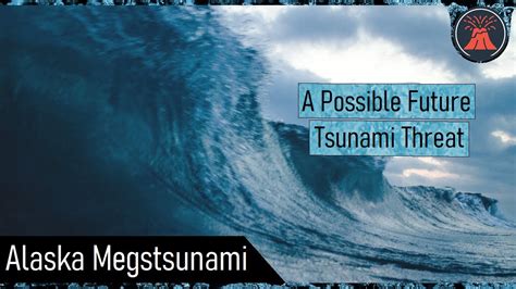
A potential mega-tsunami, triggered by a massive landslide in the Canary Islands, could unleash a 1,000-foot wave capable of devastating coastlines across the Atlantic, scientists are warning. The collapse of a portion of the Cumbre Vieja volcano on La Palma could generate a cataclysmic wave, posing a significant threat to the eastern seaboard of North America, as well as parts of Europe and Africa.
Scientists are sounding the alarm about the potential for a colossal tsunami triggered by the unstable geology of the Cumbre Vieja volcano on La Palma in the Canary Islands. New research and simulations suggest that a future eruption and subsequent landslide could displace an enormous volume of water, sending a mega-tsunami hurtling across the Atlantic Ocean. Such an event could have catastrophic consequences for coastal communities, infrastructure, and ecosystems on both sides of the Atlantic.
The primary concern stems from the potential for a flank collapse, where a large section of the volcano’s western side detaches and plunges into the ocean. While the exact size and timing of such a collapse are uncertain, geological evidence indicates that similar events have occurred in the past. According to the Yahoo News article, scientists are emphasizing that “it is not a question of if, but when” a significant landslide will occur. The impact of such an event would be far-reaching and potentially devastating, surpassing the scale of many historical tsunamis.
The simulations conducted by researchers paint a grim picture of the potential impacts. The initial landslide would generate a massive wave, estimated to be up to 1,000 feet (305 meters) high near the source. As the wave propagates across the ocean, it would gradually decrease in height, but it would still maintain considerable energy and destructive potential. Upon reaching coastal areas, the wave could inundate low-lying areas, destroy buildings, and cause widespread flooding.
“The models show that the eastern coast of North America could experience waves tens of meters high,” the article states, highlighting the vulnerability of major cities like New York, Miami, and Boston. The simulations also indicate that the coasts of Portugal, Spain, and the United Kingdom could be significantly impacted. Coastal communities in Africa, particularly in Morocco and Senegal, would also be at risk.
The potential economic consequences of a mega-tsunami are staggering. Coastal infrastructure, including ports, power plants, and transportation networks, would be severely damaged. Tourism, a major source of revenue for many coastal communities, would be devastated. The cost of rebuilding and recovery could run into hundreds of billions of dollars, if not trillions.
Beyond the immediate economic impacts, a mega-tsunami would also have profound social and environmental consequences. Millions of people could be displaced from their homes, leading to a humanitarian crisis. Coastal ecosystems, including wetlands, coral reefs, and mangrove forests, would be severely damaged or destroyed. The long-term effects on marine life and water quality are difficult to predict but could be significant.
While the threat of a mega-tsunami is real, it is important to put it into perspective. Scientists emphasize that such events are relatively rare, occurring on a timescale of centuries or even millennia. However, the potential consequences are so severe that it is essential to take the threat seriously and invest in preparedness measures.
One of the key challenges is to improve our understanding of the Cumbre Vieja volcano and the factors that could trigger a flank collapse. This requires ongoing monitoring of the volcano’s activity, including seismic activity, ground deformation, and gas emissions. Scientists are also using sophisticated computer models to simulate the behavior of the volcano and the potential impact of a landslide.
Another important aspect of preparedness is to develop effective early warning systems. These systems rely on a network of sensors that can detect the early signs of a tsunami, such as seismic waves or changes in sea level. Once a tsunami is detected, alerts can be issued to coastal communities, giving people time to evacuate to higher ground.
In addition to early warning systems, it is also important to educate the public about the risks of tsunamis and how to respond to a warning. This includes developing evacuation plans, identifying safe areas, and practicing drills. Community involvement is essential to ensure that everyone is prepared and knows what to do in the event of a tsunami.
Mitigation measures can also be implemented to reduce the potential impact of a tsunami. These include building seawalls, restoring coastal wetlands, and implementing stricter building codes in coastal areas. Land-use planning can also be used to restrict development in areas that are most vulnerable to tsunamis.
The threat of a mega-tsunami from the Cumbre Vieja volcano is a complex and challenging issue. It requires a multidisciplinary approach involving scientists, engineers, emergency managers, and community leaders. By working together, it is possible to reduce the risk and protect coastal communities from the devastating impacts of a mega-tsunami.
The Cumbre Vieja volcano, situated on the southern end of La Palma, one of the youngest and most active volcanic islands in the Canary archipelago, has been the subject of intense scientific scrutiny for decades. Its geological structure and past eruptive history reveal a pattern of instability, particularly on its western flank. This instability stems from a combination of factors, including the volcano’s steep slopes, the presence of weak rock layers, and the ongoing accumulation of volcanic material.
Previous eruptions of Cumbre Vieja have been associated with landslides and slope failures. Geological evidence indicates that a large landslide occurred approximately 560,000 years ago, generating a significant tsunami that impacted the surrounding islands. More recently, the 1949 eruption of Cumbre Vieja was accompanied by ground deformation and cracking on the volcano’s western flank, raising concerns about the potential for a future collapse.
The potential for a future flank collapse has been the subject of numerous scientific studies and debates. Some researchers believe that a large-scale collapse is inevitable, while others argue that it is less likely or that the timing is uncertain. The size of the potential landslide is also a matter of debate, with estimates ranging from tens of cubic kilometers to several hundred cubic kilometers.
The size of the landslide is a critical factor in determining the size and impact of the resulting tsunami. A larger landslide would displace a greater volume of water, generating a larger wave that would travel further and have a greater impact on coastal areas. The speed of the landslide is also important, as a faster landslide would generate a more powerful wave.
Scientists use a variety of methods to study the Cumbre Vieja volcano and assess the risk of a flank collapse. These include:
- Seismic monitoring: A network of seismometers is used to monitor the volcano’s seismic activity, which can provide clues about the movement of magma and the stability of the volcano’s flanks.
- Ground deformation monitoring: GPS instruments and satellite radar interferometry (InSAR) are used to measure changes in the shape of the volcano, which can indicate the presence of magma intrusion or slope instability.
- Gas emission monitoring: Instruments are used to measure the composition and flux of volcanic gases, which can provide information about the volcano’s activity and the potential for an eruption.
- Geological mapping: Detailed geological maps are used to identify areas of weak rock and past landslides.
- Computer modeling: Sophisticated computer models are used to simulate the behavior of the volcano and the potential impact of a landslide.
The results of these studies are used to assess the risk of a flank collapse and to develop early warning systems. However, predicting the exact timing and size of a future collapse is a challenging task, as the behavior of volcanoes is complex and unpredictable.
The potential impact of a mega-tsunami from the Cumbre Vieja volcano extends far beyond the immediate coastal areas. The wave could disrupt global trade, damage critical infrastructure, and cause widespread economic losses. The social and psychological impacts on affected populations could be long-lasting and severe.
It is important to note that the threat of a mega-tsunami is not limited to the Cumbre Vieja volcano. Similar threats exist in other volcanic islands and coastal areas around the world. For example, the Stromboli volcano in Italy and the Anak Krakatau volcano in Indonesia have also been associated with landslides and tsunamis.
The threat of tsunamis is a global issue that requires international cooperation and collaboration. This includes sharing data, developing common standards for early warning systems, and providing assistance to countries that are vulnerable to tsunamis.
The development of effective early warning systems is crucial for mitigating the impact of tsunamis. These systems rely on a network of sensors that can detect the early signs of a tsunami, such as seismic waves or changes in sea level. The data from these sensors are transmitted to tsunami warning centers, where scientists analyze the data and issue alerts to coastal communities.
Tsunami warning systems typically involve the following components:
- Seismic sensors: These sensors detect earthquakes that could generate tsunamis.
- Sea-level sensors: These sensors measure changes in sea level, which can indicate the presence of a tsunami.
- Communication systems: These systems transmit data from the sensors to tsunami warning centers and disseminate alerts to coastal communities.
- Warning centers: These centers analyze the data and issue alerts.
- Emergency management agencies: These agencies are responsible for coordinating the response to a tsunami.
- Public education programs: These programs educate the public about the risks of tsunamis and how to respond to a warning.
The effectiveness of a tsunami warning system depends on the speed and accuracy of the data processing and alert dissemination. It is also important to have effective communication channels to reach coastal communities, including remote and underserved areas.
In addition to early warning systems, it is also important to implement mitigation measures to reduce the potential impact of tsunamis. These measures include:
- Coastal zoning: This involves restricting development in areas that are most vulnerable to tsunamis.
- Building codes: This involves implementing stricter building codes in coastal areas to ensure that buildings are resistant to tsunamis.
- Seawalls and other coastal defenses: These structures can help to protect coastal areas from tsunamis.
- Restoration of coastal ecosystems: Coastal wetlands, mangrove forests, and coral reefs can help to buffer the impact of tsunamis.
- Public education: Educating the public about the risks of tsunamis and how to respond to a warning is crucial for saving lives.
The threat of a mega-tsunami from the Cumbre Vieja volcano is a reminder of the power of nature and the importance of preparedness. By investing in research, monitoring, early warning systems, and mitigation measures, it is possible to reduce the risk and protect coastal communities from the devastating impacts of tsunamis. The continuous assessment of the risk is warranted, as is the development and refinement of evacuation plans. International collaboration and knowledge sharing are equally essential for effective tsunami preparedness.
The potential for a catastrophic wave event caused by a landslide at Cumbre Vieja raises several critical questions about risk assessment, emergency preparedness, and long-term mitigation strategies. The scientific community continues to refine models and monitoring techniques to provide the most accurate possible forecasts, yet the inherent uncertainties of volcanic activity remain a significant challenge. It is vital that governments, communities, and individuals take proactive steps to understand the risks and prepare for potential impacts.
Frequently Asked Questions (FAQ):
-
What is a mega-tsunami and how is it different from a regular tsunami? A mega-tsunami is a very large tsunami, typically generated by a massive landslide or a volcanic eruption rather than an earthquake. According to the yahoo news article “it would be significantly larger than tsunamis caused by underwater earthquakes, with the potential to inundate coastlines at far greater distances”. The initial wave height can be much higher, and the energy of the wave is significantly greater, leading to more widespread and devastating impacts. While regular tsunamis often have wave heights of a few meters, a mega-tsunami could have an initial wave height of hundreds of meters.
-
How likely is a mega-tsunami to occur from the Cumbre Vieja volcano? The likelihood of a mega-tsunami from Cumbre Vieja is difficult to predict with certainty. Scientists agree that a flank collapse is possible, but the timing and size of such an event are uncertain. As indicated in the yahoo news source, experts suggest “it is not a question of if, but when” this type of event occurs. Ongoing monitoring and research are essential to refine risk assessments and improve forecasting capabilities. While such events are relatively rare on a human timescale, geological evidence suggests that similar collapses have occurred in the past.
-
Which areas are most at risk from a mega-tsunami originating from the Canary Islands? The areas most at risk include the eastern coast of North America (including cities like New York, Miami, and Boston), the coasts of Portugal, Spain, and the United Kingdom, and coastal communities in Africa, particularly in Morocco and Senegal. The extent of the impact would depend on the size of the landslide and the resulting wave height. According to current models, these areas could experience waves tens of meters high, leading to widespread flooding and destruction.
-
What measures can be taken to prepare for a mega-tsunami? Preparedness measures include developing and implementing effective early warning systems, educating the public about tsunami risks and evacuation procedures, implementing coastal zoning regulations to restrict development in vulnerable areas, and constructing coastal defenses such as seawalls. It is also crucial to practice evacuation drills and identify safe areas to which people can evacuate in the event of a tsunami warning. Ongoing monitoring of the Cumbre Vieja volcano is essential for detecting early signs of instability.
-
What is being done to monitor the Cumbre Vieja volcano? The Cumbre Vieja volcano is being monitored using a variety of techniques, including seismic monitoring, ground deformation monitoring (using GPS and satellite radar interferometry), gas emission monitoring, and geological mapping. Scientists analyze these data to assess the volcano’s activity and the potential for a flank collapse. Computer models are also used to simulate the behavior of the volcano and the potential impact of a landslide. This continuous monitoring provides crucial information for early warning systems and risk assessments.
The continued investigation of the Cumbre Vieja volcano and the potential for mega-tsunamis underscore the importance of understanding and mitigating natural hazards. The complexity of volcanic systems and the potential for catastrophic events require ongoing research, international collaboration, and a commitment to protecting vulnerable coastal communities. The information presented aims to provide a comprehensive overview of the risks and the measures that can be taken to enhance preparedness and resilience.